The project conducts a comparative landscape-level analysis of agro-ecosystems with different ecologies and degradation states at two sites located in western Kenya:
- Kericho – located in the Sondu river basin in the proximity of the Mau forest.
- Lower Nyando – located in the Nyando river basin.
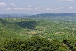
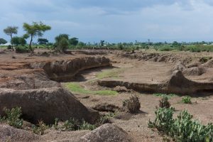
Both sites include land-use transitions from East African montane forests to grasslands and croplands. These landscapes will be classified into three different states:
- equilibrium – stable and productive;
- non-equilibrium – a variable trend;
- regime shift – stable and unproductive.
We will analyse primary productivity using high-resolution remote sensing imagery and landscape features and also conduct measurements of soil and vegetation characteristics, livestock feed quality, and livestock management. In addition, grazing exclosures cages will be used to assess vegetation composition and productivity without grazing.
The second part of the project explores the potential of plant biodiversity to restore degraded land at these sites.