
This month: psychogeography, history, and all things geospatial on the brain.
Local News
Published Papers
Here’s a Nature Scientific Reports article on “Integrating wastewater and randomised prevalence survey data for national COVID surveillance“.
Leptospirosis is a dangerous zoonotic disease often spread by rats in human settlements. A paper in PLOS Neglected Tropical Diseases examines some of the factors associated with its prevalence in an informal settlement in Brazil
I’d post some more published research but the research portal has been down for the past 24 hours and the above papers only appear because someone told me about them! Please point me to any nice spatial or mapping research for next month!
Map Fail/Win
Perhaps my monitor isn’t very well calibrated, or its just my old eyes, but I spent far too long wondering what these grey lines on a white background were before I saw the sea/land distinction. I’m betting this won’t be the last map fail we see from The Guardian!
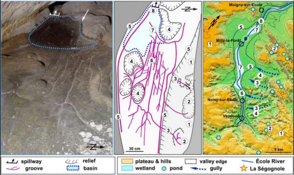
This month’s mappy win is on a historical theme, and claims to be the oldest ever 3d map. How old? Made on a BBC Micro in 1983? A PDP/11 in 1974? Papier-mâché in the French court of 1682? A marvel of Michelangelo in marble in 1527? Keep going. More like 13,000 years.
I Don’t Follow You
Two social connections this month.
Pangeo
Pangeo is “A community for open, reproducible, scalable geoscience”. If you want to science better, keep an eye on their activities in software and outreach
Steven Feldman and Mappery
I first met Steven when he chaired FOSS4G2013 and he did an amazing job to build an enjoyable Open Source Geospatial conference that year. You’ll find him on the “Fediverse” discussing maps, politics and Arsenal. He runs the Mappery server and collects “Maps in the Wild” – why not contribute? I have!
Events
Psychogeography

What? How about “the study of the precise laws and specific effects of the geographical environment, consciously organized or not, on the emotions and behavior of individuals.” Tim Waters defines it as “the cross-over of geography, psychology, and art” and to celebrate it annually he collates events for the Terminalia Festival of Psychogeography every February 23rd. Check out the events listed and either join in or do something in the spirit yourself. Traditional Psychogeographic activities include the “dérive”, a typically urban walk often controlled by random or environmental factors such as dice rolls, card draws, smells, sights or sounds.
This Terminalia Day I’m scheduled to do a fairly straight-line rural walk to a pub, which is perhaps the antithesis of the dérive, but without antithesis there can be no synthesis, or beer in this case.
Coda
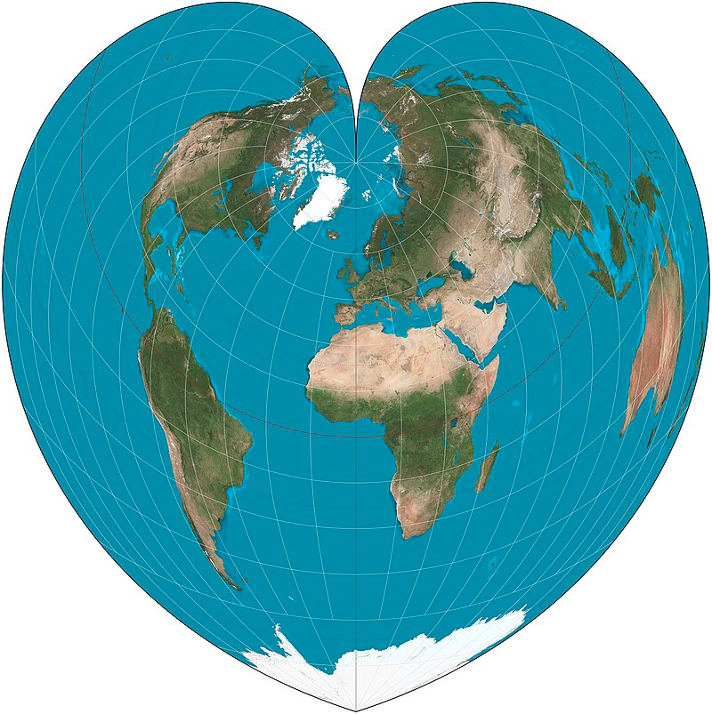
Here’s the Werner projection, strangely popular around this time of the year…
Contributions to March’s mappy madness are welcome!